Every sounding a survey vessel records is only as good as the position attached to it. A multibeam can resolve the seabed beautifully, but if the vessel’s position is a metre off, so is the chart. That is why hydrographic work is governed not by a positioning spec but by an uncertainty spec — a total budget the whole survey system has to fit inside, of which GNSS is only one part.
And offshore, that budget has to be met with no base station anywhere near you, on a platform that pitches and rolls above the flattest, wettest reflector in nature — the environment our guide to marine & offshore GNSS antennas covers in full. This guide covers what the standard actually demands, how a vessel positions itself hundreds of kilometres from shore, and where the antenna decides whether you make the order or re-run the line.
What the standard actually demands
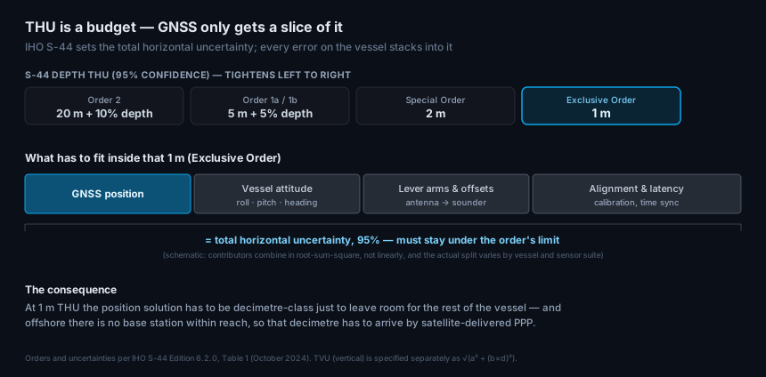
Hydrographic surveys are specified against IHO S-44, the International Hydrographic Organization’s Standards for Hydrographic Surveys. It defines survey orders, and for each one a Total Horizontal Uncertainty (THU) and Total Vertical Uncertainty (TVU) — both at 95% confidence:
| Order | Depth THU (95%) | TVU a | TVU b | Used where |
|---|---|---|---|---|
| Order 2 | 20 m + 10% of depth | 1.0 m | 0.023 | a general description of the sea floor is adequate |
| Order 1b | 5 m + 5% of depth | 0.5 m | 0.013 | under-keel clearance is not an issue for expected shipping |
| Order 1a | 5 m + 5% of depth | 0.5 m | 0.013 | under-keel clearance not critical, but features of concern may exist |
| Special Order | 2 m | 0.25 m | 0.0075 | under-keel clearance is critical |
| Exclusive Order | 1 m | 0.15 m | 0.0075 | strict minimum under-keel clearance and manoeuvrability criteria |
The maximum vertical uncertainty the standard allows grows with depth, through TVU_max(d) = √(a² + (b × d)²) — where a is the depth-independent portion in metres and b the depth-varying coefficient — so the deeper you go, the more vertical error the standard tolerates. Horizontal uncertainty only partly does: Orders 2, 1a and 1b carry a depth term, but at Special and Exclusive Order the THU is a flat 2 m and 1 m regardless of depth.
THU is a budget, not a GNSS spec
Here is the part that catches people out. THU and TVU are total propagated uncertainty — everything in the measurement chain stacks into them. The GNSS position is one contributor. Alongside it sit the vessel’s attitude (roll, pitch, and heading, which project any lever arm into a horizontal error), the lever arms and offsets from the antenna to the sounder, and sensor alignment, calibration, and time synchronisation.
So “1 m THU” is not permission for a 1 m position. Once the rest of the vessel has taken its share, the GNSS solution has to be decimetre-class to leave room — and it has to hold that while the ship works, not just at the dock. That single fact drives every decision that follows.
No base station: PPP at sea
On land, decimetre or better usually means RTK — corrections from a base station or network within a few tens of kilometres. Sail beyond that and RTK is simply unavailable; there is no base within reach and no reliable link to one.
Offshore work therefore runs on PPP — Precise Point Positioning. Rather than differencing against a nearby base, PPP models the error sources themselves (satellite orbits and clocks, and the atmosphere) and delivers those corrections from an L-band satellite, straight to the vessel, anywhere on the ocean. It is absolute positioning with no local infrastructure — which is exactly why it became the backbone of offshore survey, seismic, and dynamic positioning.
PPP’s cost is convergence: the solution needs time to settle, and it needs to re-converge after an outage. That makes two antenna properties commercially significant. Multi-band, multi-constellation reception converges faster and re-converges faster; and anything that interrupts tracking — a blocked satellite, a burst of multipath — starts that clock again. On a vessel billing by the day, convergence time is money.
And it is not only the horizontal that depends on this. Modern ellipsoidally referenced surveys take the vertical from GNSS too — the antenna’s height standing in for, or supplementing, a tide gauge — which puts the same solution straight into the TVU budget. That is the harder ask: GNSS height is typically about twice as uncertain as horizontal position, because every satellite sits above the antenna and none below it.
The vessel is a hostile RF platform
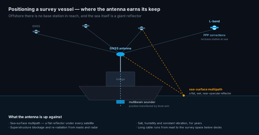
A survey vessel looks like a clean RF environment — open horizon, no urban canyon. It isn’t.
The sea is a reflector. Under every satellite lies a flat, wet, electrically conductive surface that throws strong specular reflections up into the antenna from the specular point. Sea-surface multipath is the signature marine error, and it is worse than it sounds: unlike a building, the reflector is everywhere, it moves with the swell, and it sits directly beneath the low-elevation satellites you need for good geometry.
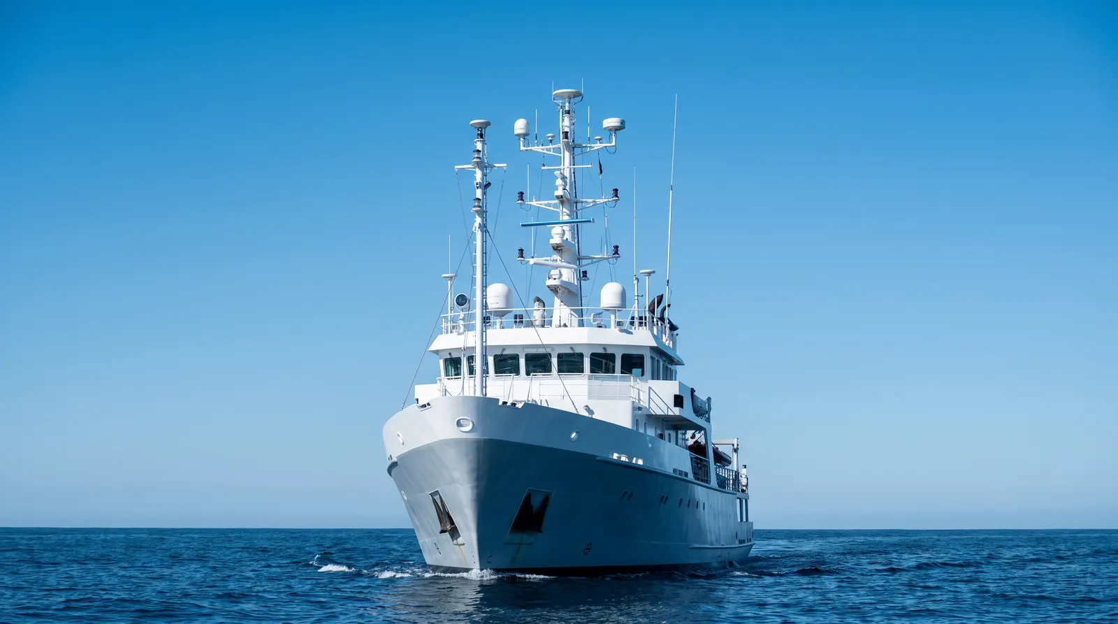
The superstructure fights back. Masts, radar, satcom domes, and comms antennas surround the GNSS antenna, blocking sky and re-radiating energy. Getting the antenna high and clear is a naval-architecture negotiation, not a free choice — and it is why antenna selection for multipath on ships and in ports is its own discipline.
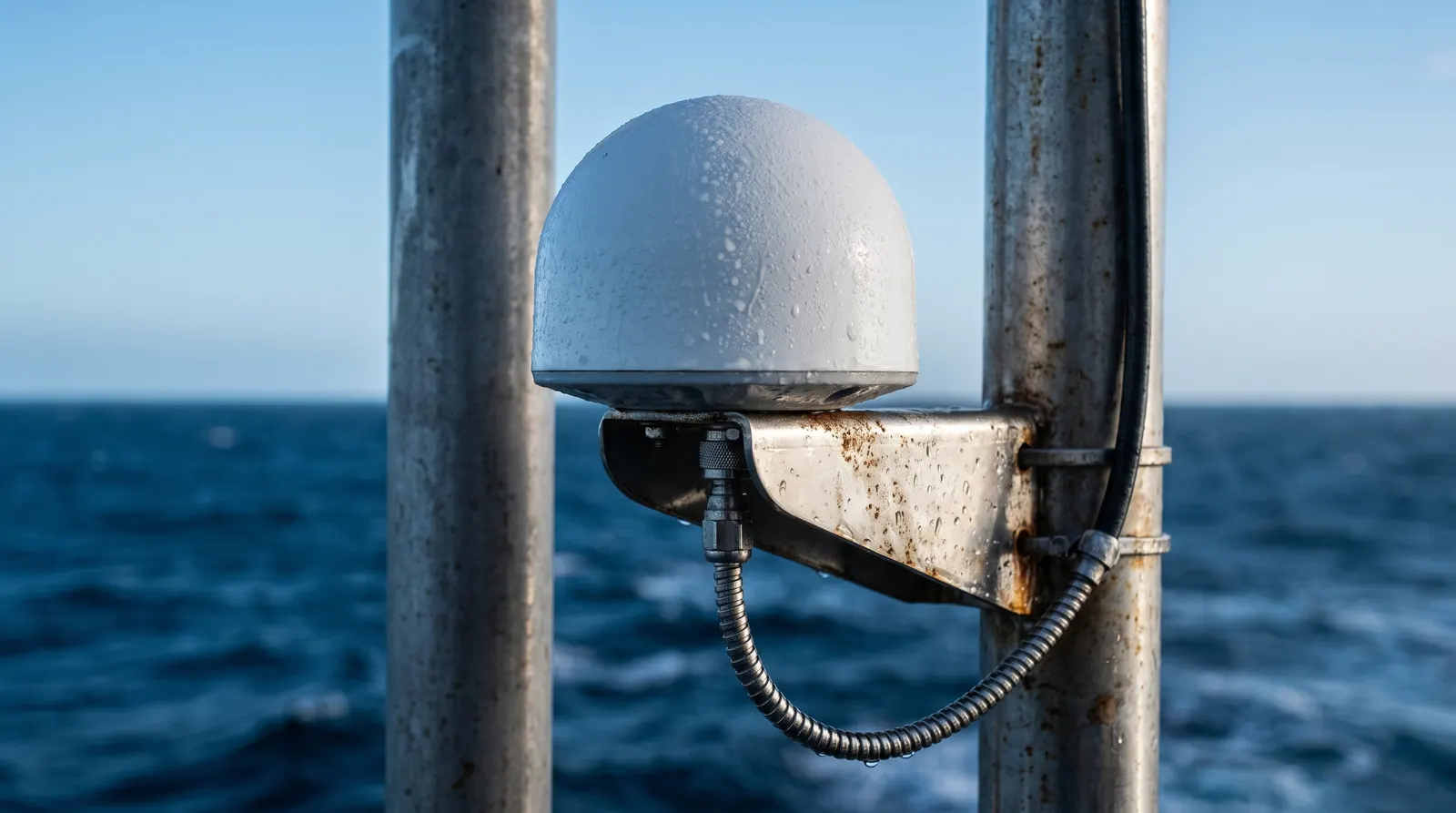
The environment never lets up. Salt, humidity, and constant vibration work on the antenna for years between dockings; marine antenna lifespan is measured in seasons of salt fog, not lab hours. And the run from masthead to the survey space below decks is long, which makes cable and connector practice part of the link budget rather than an afterthought.
Where the antenna fits
Four antenna properties decide whether the vessel makes its order:
- Multi-band, multi-constellation reception. This is what makes PPP converge quickly and re-converge after a dropout — the difference between a productive line and a re-run.
- Sea-surface multipath rejection. Good axial-ratio purity across elevations, a proper ground plane, and a controlled low-elevation pattern are what separate a survey antenna from a navigation puck here. Rejecting the reflection off the water is the single most marine-specific thing the antenna does.
- A stable, calibrated phase center. This one is easy to miss and expensive to get wrong: every lever arm on the vessel is measured from the antenna’s phase center. If it wanders with elevation or azimuth, the entire offset geometry — antenna to sounder, antenna to motion sensor — wanders with it, and the error lands straight in THU.
- Marine ruggedization. IP-rated sealing, salt-fog and damp-heat qualification, UV stability, and vibration endurance, because a masthead is not a place you revisit casually.
To those, add heading: many survey installations run dual antennas for GNSS heading, which demands a matched pair and a known baseline — and doubles everything above.
| Spec | Why it matters offshore |
|---|---|
| Multi-band, multi-constellation (L1/L2/L5) | fast PPP convergence and re-convergence; better geometry with low-elevation satellites |
| Strong multipath rejection, low axial ratio | the sea is a specular reflector under every satellite |
| Documented, stable phase center (calibrated) | it is the origin of every lever arm to the sounder |
| IP67+, salt-fog and damp-heat qualified | years on a masthead between dockings |
| Adequate LNA gain for a long masthead run | closes the link budget from mast to survey space |
| Matched pair available for dual-antenna heading | heading feeds the same THU budget |
The broader selection framework — the specs to put in an RFQ, and how they trade off — is covered in the buyer’s guide to high-precision GNSS antennas, and the hardware for this duty sits in the high-precision measurement line.
Frequently asked questions
What positioning accuracy does a hydrographic survey need? It depends on the IHO S-44 order. Exclusive Order allows 1 m Total Horizontal Uncertainty at 95%, Special Order 2 m, Orders 1a/1b 5 m + 5% of depth, and Order 2 20 m + 10% of depth. The maximum vertical uncertainty allowed follows TVU_max(d) = √(a² + (b×d)²) with order-specific a and b. Crucially these are total uncertainties for the whole system, not GNSS specs.
Why can’t offshore surveys use RTK? RTK needs corrections from a base station within roughly a few tens of kilometres, and offshore there isn’t one. Surveys therefore use PPP, which models the error sources and receives corrections from an L-band satellite — absolute decimetre-class positioning anywhere on the ocean with no local infrastructure.
Why is multipath worse at sea than on land? Because the reflector is everywhere and always beneath you. The sea surface is flat, wet, and electrically conductive — a near-specular mirror directly under the low-elevation satellites that give you good geometry, and it moves with the swell. A land site has discrete reflectors you can often site away from; a vessel cannot sail away from the water.
Why does the antenna’s phase center matter so much on a vessel? Because it is the origin of the lever arms. Every offset — antenna to multibeam, antenna to motion sensor — is measured from the antenna’s electrical phase center. If that point wanders with satellite elevation or azimuth, the whole offset geometry wanders, and the error propagates directly into the survey’s total horizontal uncertainty.
Do survey vessels need two GNSS antennas? Many do. A dual-antenna installation derives heading from the baseline between them, which matters because heading error projects any lever arm into a horizontal position error that lands in THU. It requires a matched antenna pair and an accurately known baseline.
Written by GNSource Engineering. GNSource manufactures multi-band, marine-grade GNSS antennas for offshore survey, hydrography, and vessel positioning. Talk to our engineers about a masthead antenna for a survey spread, or explore the high-precision measurement line.