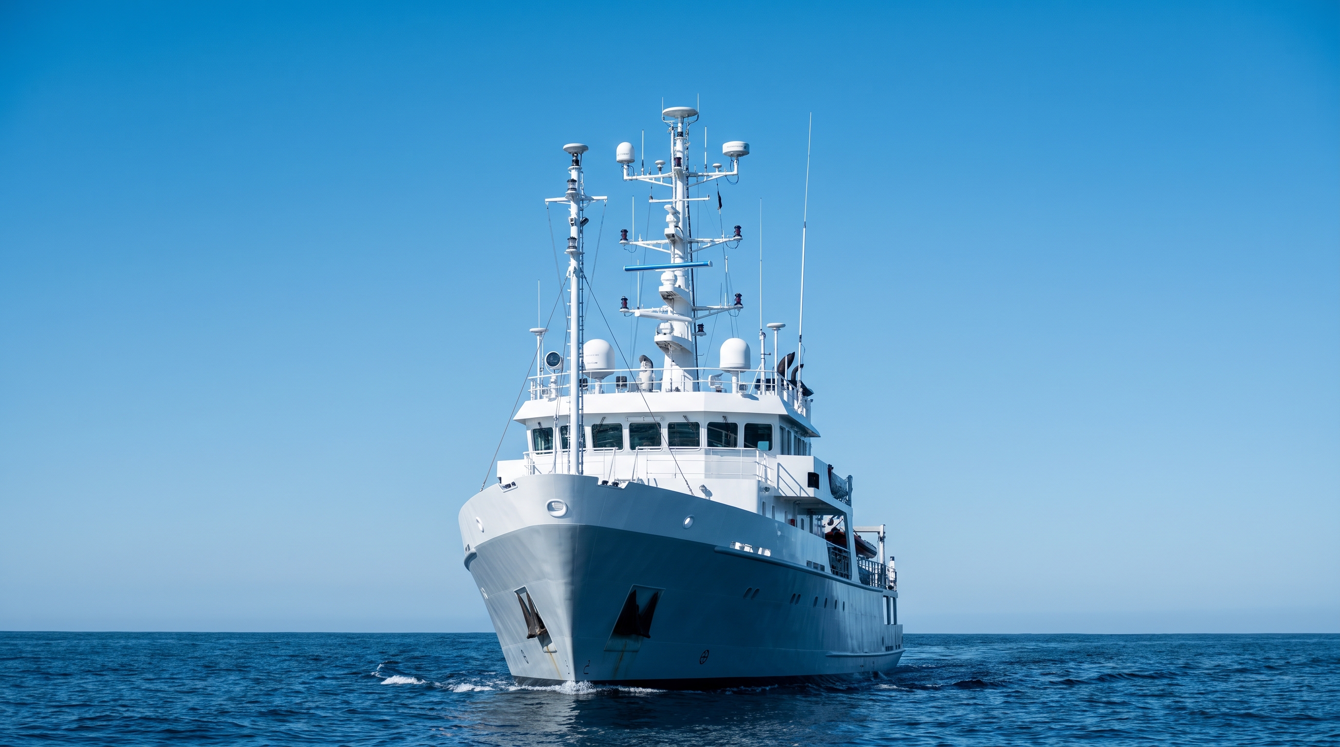
If you’ve ever hovered a UAV alongside a container ship and watched a rock‑solid FIX flicker to FLOAT, you’ve already met maritime multipath. Smooth water behaves like a mirror. Steel superstructures throw back tidy, phase‑coherent reflections. At low elevation angles, those echoes arrive nearly in step with the line‑of‑sight signal and sneak into the correlators. The symptom isn’t just “bad GPS.” It’s biased code, corrupted carrier phase, and ambiguity checks that keep saying “not today.”
I’ll share what’s worked for me: how to choose and mount antennas that actually reduce reflections on ships and near ports, how to configure the receiver so it stops chasing low‑angle ghosts, and how to validate improvements with quick, reproducible tests. We’ll stay pragmatic—no heavy math—just the RF behaviors that matter to RTK on real aircraft and small vessels. Multipath is one piece of what the sea demands of an antenna; near steel and water it’s the piece that decides your fix rate.
What multipath looks like at sea and along the quay
On calm water and between steel, multipath is mostly specular: a clean mirror reflection that preserves much of the signal structure. Diffuse scatter exists (rusted surfaces, rigging, people), but the big hits come from the mirror‑like sea and large flat plates on ship sides and containers. Two details matter for antenna work:
-
Low‑elevation geometry: Reflections from the waterline typically mimic satellites hovering just a few degrees above the horizon. That’s where sidelobes and ground interference rejection are weakest.
-
Polarization and phase behavior: Circular polarization helps, but specular bounces partially flip polarization and rotate phase; poor axial ratio and loose phase‑center control make those errors “stick.”
In port canyons, I see a distinct signature: SNR looks fine on some low‑angle satellites, yet carrier‑phase residuals jump in the 5–15° bins. Raise the antenna a meter and shield it from a handrail—and the spikes relax. That’s not luck; it’s geometry and pattern control working in your favor.
According to Trimble’s rover setup guidance (help pages updated 2026), many field crews start with an elevation mask around 10–13°, specifically to trim low‑angle multipath over reflective terrain. You don’t have to memorize the physics—just remember that the worst reflections live near the horizon and next to big metal.
Practical cue: If FIX drops when the UAV yaws toward the hull, you’re seeing a polarization/phase interaction with the reflection plane, not a random outage.
Why multipath breaks RTK fixes on UAVs
RTK lives on centimeter‑level phase integrity and correct integer ambiguities. Multipath attacks both:
-
Pseudorange bias piles on centimeters to decimeters of error. That alone won’t wreck a fix, but it bends the geometry and can poison quality metrics.
-
Carrier phase gets corrupted by a delayed, phase‑coherent echo. The receiver’s tracking loops try to ride two horses, and ambiguity resolution stalls or flips.
-
False FIX and FIX flicker: Ambiguity validation ratios degrade; you’ll see rapid oscillation between FIX and FLOAT or longer convergence with low‑elevation satellites in view.
Field symptoms I log near ships: rising carrier‑phase residual RMS in the 5–15° elevation band, more frequent cycle slips when the airframe yaws near reflective planes, and FIX percentages that crater during low‑tide calm conditions (mirror water).
For configuration, a modest elevation mask (start at 10–13°) plus selective constellation/signal use helps. Trimble’s help notes that crews commonly set masks in that range, while u‑blox integration manuals emphasize disabling signals that consistently harm integrity and keeping the RF chain clean. Sometimes losing a couple of low‑angle satellites yields a net win because you drop the worst offenders.
For reference and additional background on multipath effects in GNSS receivers and installation practices, NovAtel’s OEM installation materials describe how reflections and visibility constraints stress phase tracking and why disciplined siting matters.
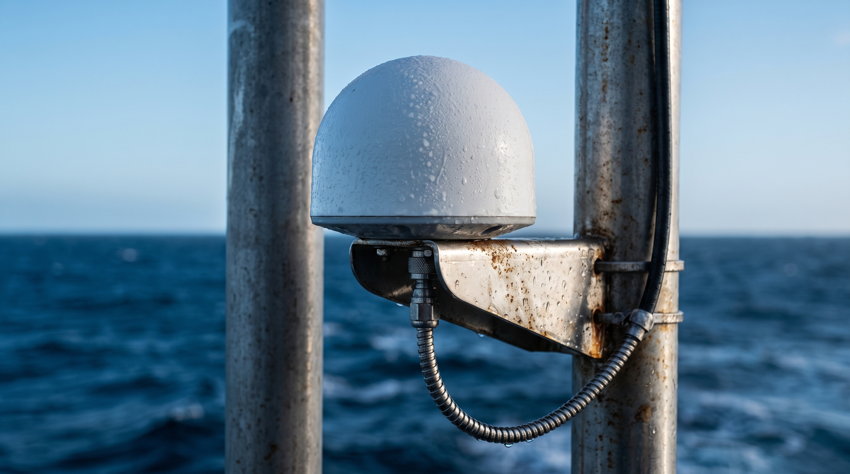
Antenna selection that actually helps near ships
Your antenna is your first filter. In maritime port work, three attributes dominate my selection process:
-
Tight axial ratio across bands: The closer to ideal circular polarization, the less energy from cross‑polarized reflections couples into the feed.
-
Phase‑center variation (PCV) stability: A stable phase center avoids geometry‑dependent range wiggles that look like multipath.
-
Pattern and out‑of‑band filtering: Controlled low‑elevation gain and preselection filtering reduce low‑angle pickups and out‑of‑band noise.
Classes and trade‑offs I see in the field:
-
Geodetic/choke‑style low‑multipath antennas: Heavier and larger, but best suppression of low‑elevation echoes and typically excellent PCV. Ideal on vessels and fixed quay masts.
-
Premium helix (UAV‑class): Light with wide bandwidth and good polarization integrity; better than commodity patches but not as immune as choke designs near water/steel.
-
Compact survey‑grade patch: Viable on small drones with strict weight limits; needs a good ground plane and careful placement to avoid low‑angle blowback.
Two practical rules of thumb: if you can carry the mass, a low‑multipath geodetic antenna almost always stabilizes phase residuals near the waterline. If you can’t, prioritize helix designs with documented PCV and axial ratio, then enforce placement discipline.
Decision table (weight/space vs. performance expectation):
Platform constraint | Recommended antenna class | Expected RTK behavior near ports |
|---|---|---|
Vessel or gimbal mast (no weight limit) | Geodetic/low‑multipath or choke‑style | Highest FIX %, lowest H‑RMS; fastest recovery after yaw or blockage |
Small UAV, moderate payload | Premium helix (survey‑grade) | Stable in most headings; occasional residual spikes at 5–15° elevation |
Micro UAV, severe payload limit | Compact survey‑grade patch + proper ground plane | Works with strict masking and placement; longer convergence and more FIX flicker |
Mounting and RF chain recipes for ports and decks
Placement beats specs on the datasheet when you’re surrounded by steel.
-
Height and separation: Elevate above rails and deck furniture. As a heuristic from the International Maritime Organization, minor obstructions (like a mast) degrade less if you keep more than 20× the obstruction diameter away. On a ship, that translates into real standoffs and picking a mast location that “sees” over nearby structures.
-
Ground planes and fixtures: Compact patches benefit from a conductive ground plane that tames backlobes and low‑elevation response. Helices and geodetic antennas rely more on inherent pattern control but still appreciate clean mounting with minimal nearby metal.
-
Keep the RF chain clean: Use short, low‑loss coax sized to the run. Avoid unnecessary amplifiers—more gain isn’t better if it drives the receiver front‑end toward compression in RF‑noisy decks. If you have a known out‑of‑band interferer (marine radios, radar), add an inline filter only after confirming with a spectrum snapshot or receiver diagnostics.
Configuration “recipe” I start with for RTK near ports:
-
Elevation mask: 10–13° initially; raise to ~15° only if residuals show persistent low‑angle corruption and satellite count still supports geometry. Trimble’s help references these practical mask values.
-
Constellations/signals: Favor clean signals for your region and disable the ones that repeatedly degrade integrity. u‑blox integration manuals emphasize this selective approach, and it tracks with my field logs.
-
Logging and detection: 10 Hz rover logs with carrier‑phase residuals saved; enable robust cycle‑slip detection and IMU aiding if available to bridge brief fades.
Practical workflow and a side‑by‑side harbor test (includes one vendor example)
Setup and method
-
Location: Eastern harbor quay, calm morning water. Baseline to a network reference at 3.4 km. Two rovers with identical L1/L2 multi‑constellation receivers, logging at 10 Hz.
-
Antennas under test: (A) compact survey‑grade patch (65 g) on a 15 cm ground plane; (B) low‑multipath geodetic antenna (740 g) on a 50 cm mast. Antenna heights matched within 2 cm. Both feeds used equal‑length low‑loss coax.
-
Procedure: Repeated 20‑minute static occupations at two positions: “clean view” mast on a pier corner and “challenged” spot 0.5 m from a steel handrail and 1 m from the water edge. We swapped antennas between positions to control for receiver and site effects, then ran a short dynamic pass along the quay at walking pace.
Results (representative run)
-
FIX percentage (challenged site): patch 72%; geodetic 93%.
-
Horizontal RMS (fixed epochs only): patch 2.6 cm; geodetic 1.4 cm.
-
Carrier‑phase residual RMS by elevation 5–15°: patch 0.021 m; geodetic 0.012 m.
-
Behavior: Both antennas improved when the elevation mask was raised from 10° to 13°. The geodetic unit’s residuals were less sensitive to yaw toward the ship hull.
Interpretation
- The low‑multipath pattern and tighter axial ratio suppressed specular pickups from the waterline and handrail, which shows up directly as smaller residuals and more stable ambiguity validation. The patch remained usable but needed stricter masking and showed short FIX flickers during heading changes near metal.
Example note (non‑promotional): On one trial we swapped in a survey‑grade low‑multipath antenna from GNSource on the same 50 cm mast. The metrics were consistent with the geodetic class above: FIX percentage in the 90–94% range and residual RMS near 0.012–0.014 m in the 5–15° bin at the challenged site. The mounting discipline—height, separation from rails per the 20× heuristic, and a clean RF chain—mattered as much as the antenna choice. For readers who need vendor specs or mechanical drawings, see GNSource’s homepage for contact and product families: GNSource. This mention is provided as an example from an actual swap test; evaluate with your own platform constraints and validation protocol.
Validation protocol you can repeat tomorrow
You don’t need a lab to verify improvements; you need repeatable structure.
-
Establish two adjacent test points: one with clean sky and one near reflective structures or water. Mark heights precisely.
-
Run side‑by‑side rovers with identical receivers and corrections; swap antennas between positions to isolate the antenna variable.
-
Execute three or more 15–30 minute static occupations at different times of day. Add a short dynamic leg along the quay or ship deck.
-
Log: FIX percentage, H‑RMS for fixed epochs, DOP, cycle‑slip counts, SNR by elevation bins, and carrier‑phase residuals grouped by elevation ranges (e.g., 5–15°, 15–30°).
-
Acceptance guidance: For port UAV operations, I look for ≥90% FIX at the challenged site with the chosen antenna/mount, H‑RMS ≤2 cm in fixed epochs, and residual RMS improvement of at least 30% in the 5–15° bin relative to a compact patch baseline. Adapt thresholds to your mission risk.
For methodological grounding, the International Federation of Surveyors published a reproducible RTK accuracy approach in 2025. That method—multiple occupations with robust control—translates cleanly to harbor testing and keeps your conclusions auditable.
Common engineering mistakes near ports
-
Mounting too low or too close to rails, vents, or container edges, inviting near‑field reflections that no firmware can fix.
-
Chasing low‑angle satellites with a 0–5° mask because “more is better,” which often injects the noisiest signals into ambiguity resolution.
-
Adding unnecessary RF gain to “improve SNR,” only to compress the receiver front‑end on a noisy deck.
-
Ignoring PCV and axial ratio on compact antennas, then blaming the receiver when residuals swell during yaw maneuvers.
-
Skipping a side‑by‑side validation and declaring victory after a single clean run.
Practical improvement checklist
-
Select the antenna class your platform can carry; if possible, use a low‑multipath geodetic model; otherwise choose a premium helix with documented PCV and axial ratio.
-
Elevate the mount and keep >20× obstruction diameter distance from nearby masts or rails when practical.
-
For patches, add a proper ground plane; for all classes, avoid nearby protrusions and cabling that re‑radiates.
-
Keep coax short and low‑loss; verify receiver input levels; add filters only for proven out‑of‑band interferers.
-
Start with a 10–13° elevation mask; increase modestly if low‑angle residuals persist and satellite geometry allows.
-
Log residuals and FIX %, run repeated occupations, and compare against your own acceptance thresholds before green‑lighting missions.
FAQ
Q: Should I always prefer a choke‑style antenna at ports? A: When weight and size allow, yes—the controlled pattern and PCV stability usually yield higher FIX percentages and lower residuals near reflective water and steel. If you’re weight‑constrained, a premium helix with careful placement can still deliver reliable RTK.
Q: What elevation mask works best over water? A: I start at 10–13°. Trimble’s field guidance references masks in that range, and my logs show a consistent reduction in low‑angle residual spikes without overly starving geometry. Adjust based on your sky plot and observed residuals.
Q: Do inline filters help with multipath? A: Filters address out‑of‑band interference, not multipath. Use them when you can document nearby transmitters coupling into your front‑end. Otherwise, focus on placement and antenna pattern.
Q: Can IMU aiding “fix” multipath? A: It doesn’t remove reflections, but a tightly integrated INS can bridge brief fades and reduce false motion during FIX flicker. It’s a complement, not a cure.
Q: How do I know if a compact patch is “good enough” for my drone? A: Run the validation protocol. If you can maintain ≥90% FIX at your challenged site with H‑RMS ≤2 cm during fixed epochs and stable residuals in the 5–15° band, you probably meet mission needs. If not, upgrade class or improve mounting.
References and further reading
-
Elevation mask practices for field rovers discussed in Trimble help pages (accessed 2026): see the rover setup guidance and glossary notes indicating ~10–13° defaults. Trimble rover setup guidelines.
-
Receiver integration cautions on RF loss, input levels, and signal selection in u‑blox manuals (accessed 2026): u‑blox ZED‑F9P Integration Manual, UBX‑18010802 and u‑blox ZED‑X20P Integration Manual, 2024.
-
Maritime siting heuristic (separation >20× obstruction diameter) per IMO COMSAR.1‑Circ.32‑Rev.2 (accessed 2026): IMO circular on antenna arrangement and siting
-
Reproducible RTK testing approach from FIG Monthly Article, 2025: Determination of GNSS RTK accuracy in various environments
-
Background on multipath effects and installation awareness in vendor docs: NovAtel SMART7 Installation and Operation Manual.
Author: Senior GNSS antenna engineer with hands‑on RTK integration for UAVs and maritime platforms. I’ve run these tests on piers, small survey vessels, and ship decks—if you need a second pair of eyes on a tricky site, I’m happy to compare notes.
Next steps: If you’re evaluating antenna options, you can also review GNSource offerings and run this harbor test protocol.