A self-driving car asks two questions of its positioning system, over and over, several times a second: where am I, and how sure can I be? The first is about accuracy — staying in the right lane. The second is about integrity — knowing, with a quantified confidence, whether the answer can be trusted at all. Accuracy is the easy half. A car that is usually accurate but occasionally, silently wrong is far more dangerous than one that knows when it has lost the plot and hands back control.
That distinction shapes everything about how GNSS is specified for autonomous driving. This guide covers what the vehicle actually requires — lane-level accuracy and integrity — how the positioning stack delivers it through GNSS corrections and sensor fusion, why a city drive is a running battle to keep the fix trustworthy, and where the antenna, sitting at the exposed front of the whole chain, decides how often the car can rely on GNSS at all.
How accurate must an autonomous vehicle be?
Start with geometry. A highway lane is about 3.5 m wide and a car is roughly 1.8 m, so the vehicle has under a metre of slack on each side. To keep a car confidently in its lane, one published requirements analysis (Jing et al., Remote Sensing, 2023) synthesizes a horizontal accuracy target of about 0.42 m at 95% confidence, with a horizontal alert limit near 1.22 m — the largest position error that can be tolerated before the car might stray dangerously within, or out of, its lane.
Those numbers are useful, but they are not the whole safety story. 0.42 m at 95% says nothing about the other 5% — and it is the rare, large, undetected error that causes a crash, not the typical one.
Accuracy isn’t the hard part — integrity is
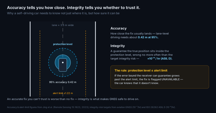
Integrity is the concept that makes GNSS safe to drive on, and it is borrowed straight from civil aviation. Instead of just reporting a position, an integrity-aware system computes a protection level — a bound it can guarantee the true position sits within, and it is wrong no more often than a stated target integrity risk. Aviation sets that risk around 10⁻⁷ per hour; mapped onto automotive functional safety, the highest safety level, ASIL D, corresponds to roughly 10⁻⁸ per hour.
The operating rule is simple and strict: the protection level must stay at or below the alert limit. As long as the bound the system can honestly guarantee is tighter than 1.22 m, GNSS is trustworthy and the car drives on it. The moment the protection level grows past the alert limit — in a dense urban canyon, say — the fix is declared unavailable, and the vehicle falls back to other sensors or hands control back. The system’s real job is not to be accurate; it is to never be confidently wrong. An accurate fix you cannot trust is worse than no fix at all.
This is why a self-driving car cannot simply use a better consumer GNSS receiver. It needs a positioning solution that produces an honest protection level — and that honesty starts with the quality of the signals the antenna delivers.
The positioning stack: GNSS, corrections, and fusion
Lane-level accuracy with automotive integrity is not something raw GNSS delivers alone. It is built in layers.
Multi-band, multi-constellation GNSS is the foundation — tracking GPS, Galileo, BeiDou, and GLONASS across L1/L2/L5 gives the receiver the redundancy it needs both to resolve ambiguities and to cross-check measurements for integrity.
Corrections take it to lane level. RTK delivers instantaneous centimetre accuracy but is local (tied to a base within roughly 75 km) and requires a two-way link. PPP with state-space (SSR) corrections trades a little accuracy for decimetre-level positioning over a whole region, delivered one-way — which scales to a national fleet far more easily. Production vehicles increasingly use PPP-style corrections for exactly that reason.
Sensor fusion provides availability and continuity. No single sensor works in every scene, so GNSS is fused with an inertial measurement unit, wheel odometry, and steering angle. When GNSS is strong, it anchors the fusion to an absolute, drift-free reference; when GNSS weakens or drops, the inertial and odometry data carry the position forward. This is dead reckoning, and it is what gets a car through a tunnel.
Keeping position through the city
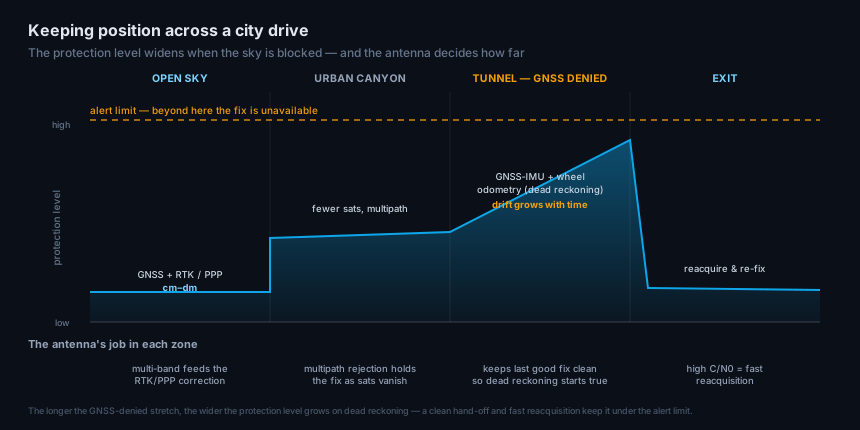
A real drive is a running fight to keep the protection level under the alert limit, and the city is where it is hardest.
In open sky, GNSS plus corrections holds the protection level tight — centimetres to decimetres — and the car drives confidently on GNSS. Enter an urban canyon and the sky narrows: buildings block satellites and, worse, bounce their signals. A reflected signal the receiver mistakes for a direct one is multipath — the single largest error source for automotive GNSS, and a particularly nasty one, because it corrupts the position while looking like a valid measurement. The protection level widens. In a tunnel, GNSS disappears entirely and the car runs on dead reckoning; the inertial solution drifts, so the protection level ramps upward with time and distance — and if the tunnel is long enough, it will eventually reach the alert limit. At the exit, the car has to reacquire satellites and pull the protection level back down as fast as possible.
The parallel with timing holdover is exact: every GNSS-denied stretch is a countdown, and the cheapest way to win it is to keep GNSS locked and clean whenever the sky is even partly visible. That is an antenna problem.
Where the antenna fits
The antenna sits at the very front of the stack, and it shapes both halves of the requirement — accuracy and integrity — before the receiver sees a single measurement.
- Multi-band, multi-constellation reception. More signals across more bands feed the corrections and give the integrity engine the redundancy it needs to detect and exclude a bad measurement. Fewer signals mean a looser protection level.
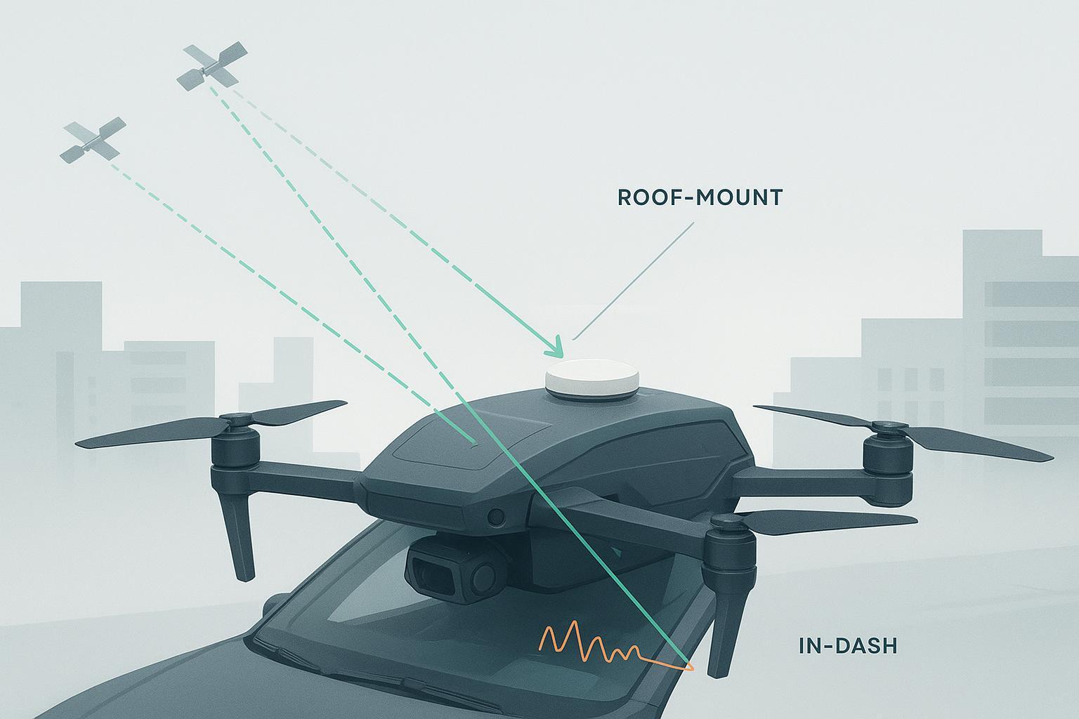
- Multipath rejection. This is the antenna’s highest-value contribution to a self-driving car. Strong axial-ratio purity, a proper ground plane, and a controlled low-elevation pattern reject the reflected signals that dominate urban error. Because multipath is the error most likely to slip past the integrity check looking valid, rejecting it at the antenna is a direct contribution to integrity, not just accuracy — the same reason roof placement beats an in-dash mount.
- A stable, calibrated phase center. Centimetre positioning references the antenna’s electrical phase center; if it wanders, the accuracy target is gone before fusion starts.
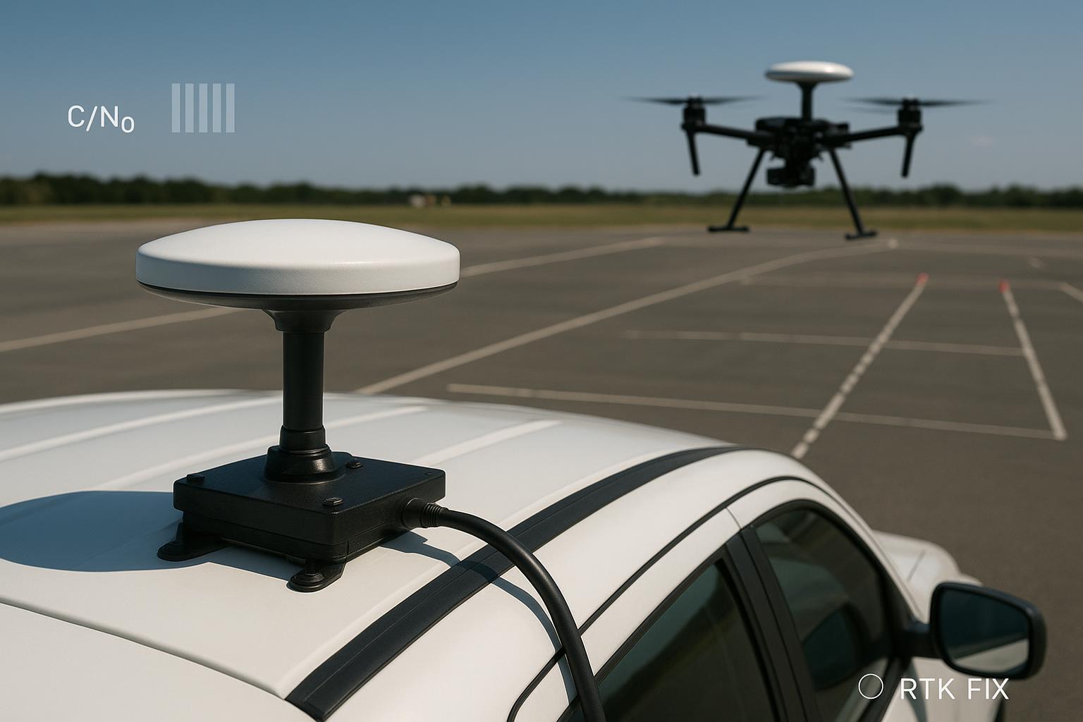
- A clean carrier-to-noise floor and fast reacquisition. High C/N0 means the receiver reacquires quickly at a tunnel exit and holds lock through partial obstruction — shortening every dead-reckoning countdown.
These are the traits that separate an automotive positioning antenna from a consumer one, and they build directly on the multi-band, multi-constellation fundamentals and the broader vehicle and autonomous-system antenna practices covered elsewhere on the blog.
Automotive-grade qualification
A positioning component in a car is a safety component, and it has to be qualified like one. The antenna and its integration sit inside a chain governed by ISO 26262, the functional-safety standard for road-vehicle electronics, whose ASIL A–D levels set how rigorously each element must be developed and validated; positioning inputs to driver-assistance and automated-driving functions commonly target ASIL B and above. Alongside it sit AEC-Q100 for component reliability, IATF 16949 for the quality system, and ISO/SAE 21434 for cybersecurity. On top of the electrical requirements, an automotive antenna must survive years of vibration, thermal cycling from −40 °C, salt, and water ingress — the same ruggedization discipline as any outdoor GNSS antenna, held to automotive volumes and automotive paperwork.
None of this is optional for a vehicle that will carry passengers on public roads. It is the difference between a part that works on the bench and one a program can actually ship.
Frequently asked questions
How accurate does GNSS need to be for a self-driving car? Lane-keeping needs roughly lane-level accuracy — one published analysis synthesizes about 0.42 m horizontal at 95% confidence, with an alert limit near 1.22 m, given ~3.5 m lanes. But accuracy alone isn’t the safety metric; the system also has to guarantee integrity — a protection level that bounds the true error at a target integrity risk near 10⁻⁸ per hour for the highest safety level (about 10⁻⁷ in aviation).
What is GNSS integrity, and why does it matter more than accuracy? Integrity is a quantified guarantee that the true position lies within a computed protection level, wrong no more often than a target integrity risk. It matters because a rare, large, undetected error causes crashes — not the typical small one. If the protection level exceeds the alert limit, an integrity-aware system flags the fix as unavailable rather than reporting a position it can’t trust.
RTK or PPP for autonomous vehicles? Both are used. RTK gives instantaneous centimetre accuracy but is local (tied to a base station) and needs a two-way link. PPP with SSR corrections gives decimetre accuracy over a wide area, one-way, which scales to a national fleet far more easily — so production vehicles increasingly lean on PPP-style corrections, often blended with local RTK where available.
How does a self-driving car keep position in tunnels? By dead reckoning — fusing GNSS with an inertial measurement unit, wheel odometry, and steering angle. When GNSS drops, the inertial solution carries the position forward, but it drifts, so the protection level grows with time and distance. A clean, fast-reacquiring antenna shortens each GNSS-denied stretch and keeps the drift within limits.
Why does the antenna matter so much for automotive GNSS? Because it shapes accuracy and integrity before the receiver sees anything. Multipath — reflected signals in urban canyons — is the dominant automotive error and the one most likely to slip past integrity checks; a multipath-rejecting, multi-band antenna on the roof is the first and most effective defense, and it must be qualified to automotive standards (ISO 26262, AEC-Q100).
Written by GNSource Engineering. GNSource manufactures multi-band, multi-constellation GNSS antennas for vehicles and autonomous systems. Talk to our engineers about a roof-mount antenna for a lane-level positioning stack, or explore the vehicle-mounted antenna line.